


 Art & Design
 Auto & Vehicles
 Beauty
 Business
 Education
 Entertainment
 Finance
 Food & Drink
 Health & Fitness
 House & Home
 Libraries & Demo
 Lifestyle
 Maps & Navigation
 Medical
 Music & Audio
 Parenting
 Personalization
 Photography
 Productivity
 Shopping
 Social
 Sports
 Tools
Tools Travel & Local
 Video Players
 Weather
 Family


 Topographic Maps & Trails
OS :
Version :1.2.10
Size :38.19Mb
Updated :Dec 22,2021
Developer :LW Brands, LLC
 Ask AI
You can ask
the AI some questions about the app
Here are three topics that users may discuss about the Topographic Maps Trails app, turned into questions for you:
1. What features do you like most about the app's trail navigation and route planning capabilities?
2. How do you find the accuracy of the app's topographic maps and elevation data for your outdoor adventures?
3. Have you used the app's offline mode for hiking or backpacking, and what was your experience like?
 Ask AI
Pros and Cons from users' feedback
I'd be happy to help you with that! After analyzing the user reviews on the Apple App Store, here are three pros and three cons of the Topographic Maps & Trails app:
Pros:
1. Accurate maps and trail information provide a sense of security for outdoor enthusiasts.
2. User-friendly interface makes it easy to navigate and plan routes.
3. Offline access allows for seamless use in areas with limited internet connectivity.
Cons:
1. Some users find the app's user interface cluttered and overwhelming.
2. Limited customization options for map layers and settings.
3. Occasional errors in trail data and map rendering can be frustrating.
Please note that these are general summaries based on the user reviews, and individual experiences may vary. If you'd like me to elaborate on any of these points or provide more information
App
Downloads
<
>

App
Survey
-
Whether the application ad recommendation affects the experience?
-
Where do you get the new APP
-
Application technology innovation Does it affect the experience?
-
The degree of memory and power consumption Does it affect the experience?
Description
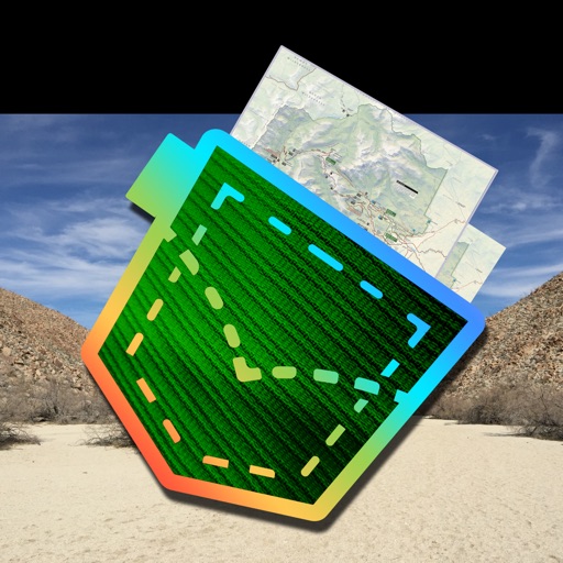
** The #1 Topo Maps App for iOS **
MAIN FEATURES INCLUDE:
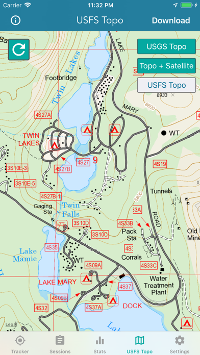
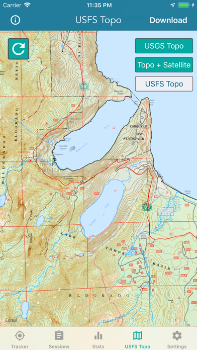
- USGS Topographic Maps
- USFS Topographic Maps
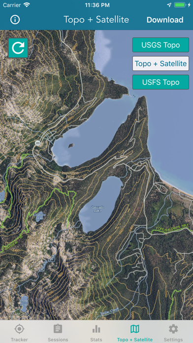
- Satellite + Topo Maps
- Hiking Tracker
* Download all maps for offline use
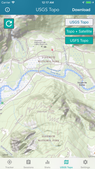
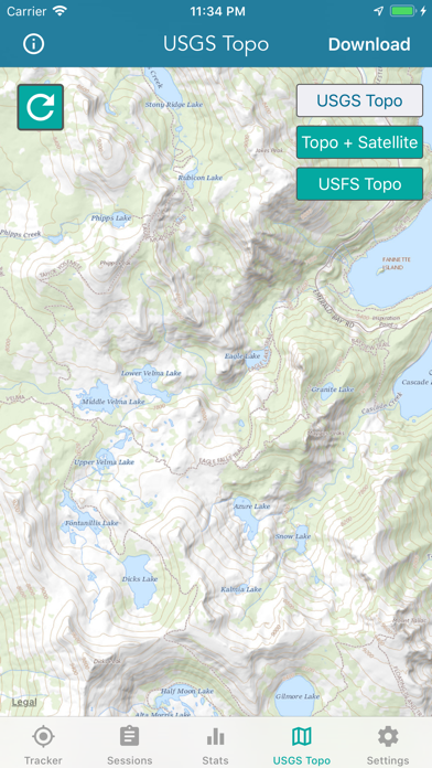
USGS TOPO MAP
USGS Topo is a tile cache base map service that combines the most current data in The National Map (TNM), and other public-domain data, into a multi-scale topographic reference map.
TOPO + SATELLITE
USGS Imagery Topo is a tile cache base map of orthoimagery in The National Map and US Topo vector data. Orthoimagery data are typically high resolution images that combine the visual attributes of an aerial photograph with the spatial accuracy and reliability of a planimetric map.
Data themes included are Boundaries, Geographic Names, Transportation, Contours, Hydrography, Land Cover, Shaded Relief, Trails, etc.
USFS TOPO MAP
The USFS Topo Map Area of Interest covers the USFS National Forests and Grasslands.
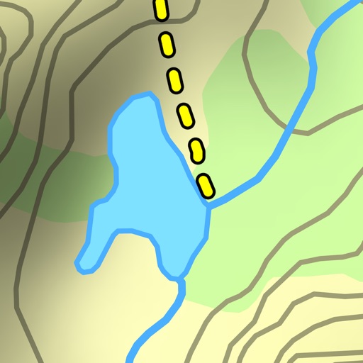
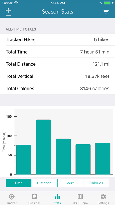
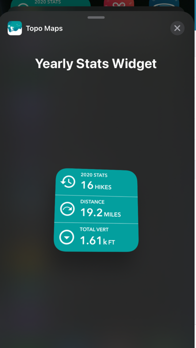
HIKING TRACKER
Now you can track all of your hiking stats!
- Track total distance, vertical, time
- Track calories burned
- Keep track of yearly stats
- Color coded tracks by elevation
- Backup your hike data to iCloud
- iOS 14 home screen widget
Have questions?
Feel free to contact me at [email protected]
{{descriptionMoreText}}
Comments (2)
{{commentText.length}}/{{maxCommentText}}
{{commentError}}{{commentUserError}}
-
{{comment.commentUser.substring(0, 1)}}By {{comment.commentUser}}{{comment.commentDateString}}
-
vBy vbmikeOct 5,2020
-
pBy prtnsrvAug 23,2019
Developer apps
 National Hurricane Center Data
 Marine Weather Forecast Pro
 Lake Ontario Boating Weather
 Canada Marine Weather Forecast
 Boating Weather and Tides
 Elk Calls & Hunting Sounds
 New Years Resolutions Tracker
 Fishing Weather Forecast
 Topo Map & Hiking Tracker
 Lake Erie Boating Weather
 Turkey Call App
 Lightning Tracker & Storm Data
 Softball Radar Gun +
 Surf Report and Forecast Tool
 High Tide - Charts and Graphs
 Golf Swing Speed Analyzer
 Florida Boating Weather
 Snowmobile Trails - New York
 Birthday Countdown & Gift List
 River Levels & Flows
 Ocean Water Temperature
 Baseball Radar Gun +
 Coyote Calls & Predator Sounds
 Great Lakes Boating Weather
 Wildfire - Fire Map Info
 Deer Calls & Hunting Sounds
 CDOT Colorado Road Conditions
 NOAA Marine Forecast & Weather
 Snow Report & Forecast
 Ski Tracker & Snow Forecast
 Wind Speed Forecast App
 Christmas Gift List Tracker
 National Weather Forecast Data
 Aurora Forecast & Alerts
 Nautical Charts & Maps
 Road Conditions - California
Category Top
apps
- Google Play
- App Store


More Apps


