


 Art & Design
 Auto & Vehicles
 Beauty
 Business
 Education
 Entertainment
 Finance
 Food & Drink
 Health & Fitness
 House & Home
 Libraries & Demo
 Lifestyle
 Maps & Navigation
 Medical
 Music & Audio
 Parenting
 Personalization
 Photography
 Productivity
 Shopping
 Social
 Sports
 Tools
Tools Travel & Local
 Video Players
 Weather
 Family


 Nautical Charts & Maps
OS :
Version :1.5
Size :15.86Mb
Updated :Jun 18,2022
Developer :LW Brands, LLC
 Ask AI
You can ask
the AI some questions about the app
Here are three topics that users may discuss about the Nautical Charts Maps app, turned into questions:
1. How do you find the accuracy of the app's charts and maps for navigation purposes?
2. Are the app's features and tools user-friendly and easy to navigate for beginners?
3. Have you experienced any issues with the app's compatibility with your device or operating system?
 Ask AI
Pros and Cons from users' feedback
I'd be happy to help you with that! After analyzing the user reviews on the Apple App Store, here are three pros and three cons of the Nautical Charts & Maps app:
Pros:
1. Accurate and detailed charts: Users praise the app's accurate and detailed charts, making it easy to navigate.
2. User-friendly interface: Reviewers appreciate the app's intuitive interface, making it simple to use.
3. Offline access: Many users appreciate the ability to access charts offline, making it useful for boating trips.
Cons:
1. Limited coverage: Some users note that the app's coverage is limited, with missing charts and areas.
2. Slow loading times: A few reviewers mention slow loading times, which can be frustrating.
3. No real-time updates: Users wish for real-time updates to
App
Downloads
<
>
App
Survey
-
Whether the app response speed affects the experience?
-
Do you think the aesthetics of the interface UI affects the experience?
-
Application technology innovation Does it affect the experience?
-
Application interactivity Does it affect the experience?
Description
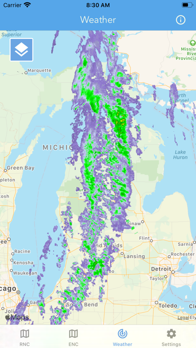
Main Features Include:
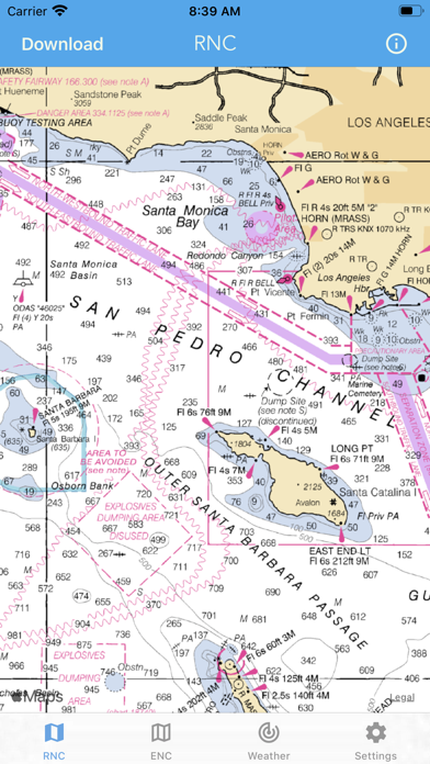
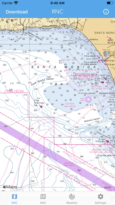
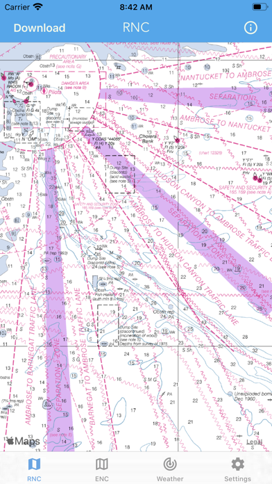
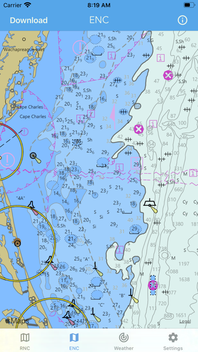
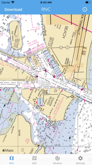
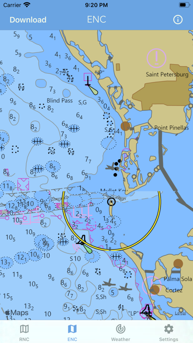
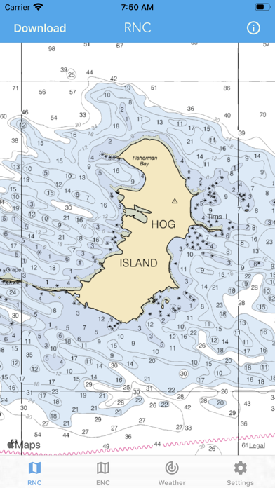
+ NOAA Electronic Navigational Charts (ENC)
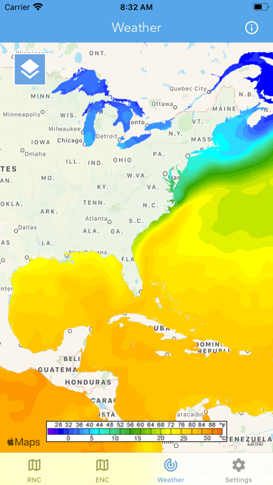
+ NOAA Weather Map Overlays
-- ELECTRONIC NAVIGATION CHARTS --
Electronic Navigational Charts (ENC) are vector data sets that support all types of marine navigation.
+ All charts are available to download for offline use
+ Chart format options include: NOAA, ECDIS
ENC charts display the following information:
+ Buoys, Beacons, Lights, Fog Signals, Radar
+ Natural and Man-Made Features
+ Services and Small Craft Facilities
+ Seabed, Obstructions, Pipelines
+ Depths, Currents
+ Port Features
+ Traffic Routes
+ Special areas
NOAA updates the ENCs for Notice to Mariners on a weekly basis. Timing of their availability is not guaranteed.
The ENC charts displayed in this app does NOT meet federal chart carriage regulations for regulated vessels.
Users should consult the Code of Federal Regulations for current federal chart carriage requirements.
-- NOAA WEATHER MAP OVERLAYS --
+ Weather Radar
+ Sea Surface Temperature
+ Significant Wave Height
+ Wind Speed & Direction
+ 12-Hour Rain Probability
+ Lightning Strike Density
+ Air Temperature
If you have any questions, please email [email protected]
{{descriptionMoreText}}
Comments (2)
{{commentText.length}}/{{maxCommentText}}
{{commentError}}{{commentUserError}}
-
{{comment.commentUser.substring(0, 1)}}By {{comment.commentUser}}{{comment.commentDateString}}
-
GBy Glide2277Jul 1,2019
-
mBy mycarmanApr 13,2019
Developer apps
 National Hurricane Center Data
 Marine Weather Forecast Pro
 Lake Ontario Boating Weather
 Canada Marine Weather Forecast
 Boating Weather and Tides
 Elk Calls & Hunting Sounds
 New Years Resolutions Tracker
 Fishing Weather Forecast
 Topo Map & Hiking Tracker
 Lake Erie Boating Weather
 Turkey Call App
 Lightning Tracker & Storm Data
 Softball Radar Gun +
 Surf Report and Forecast Tool
 High Tide - Charts and Graphs
 Golf Swing Speed Analyzer
 Florida Boating Weather
 Snowmobile Trails - New York
 Birthday Countdown & Gift List
 River Levels & Flows
 Ocean Water Temperature
 Baseball Radar Gun +
 Coyote Calls & Predator Sounds
 Great Lakes Boating Weather
 Topographic Maps & Trails
 Wildfire - Fire Map Info
 Deer Calls & Hunting Sounds
 CDOT Colorado Road Conditions
 NOAA Marine Forecast & Weather
 Snow Report & Forecast
 Ski Tracker & Snow Forecast
 Wind Speed Forecast App
 Christmas Gift List Tracker
 National Weather Forecast Data
 Aurora Forecast & Alerts
 Road Conditions - California
Category Top
apps
- Google Play
- App Store


More Apps


