


 Art & Design
 Auto & Vehicles
 Beauty
 Business
 Education
 Entertainment
 Finance
 Food & Drink
 Health & Fitness
 House & Home
 Libraries & Demo
 Lifestyle
 Maps & Navigation
 Medical
 Music & Audio
 Parenting
 Personalization
 Photography
 Productivity
 Shopping
 Social
 Sports
 Tools
Tools Travel & Local
 Video Players
 Weather
 Family


 Trailforks
OS :

Version :1.58.6/1.60.1
Size :/195.99Mb
Updated :Aug 4,2022
Oct 28,2022
Oct 28,2022
Developer :Trailforks
 Ask AI
You can ask
the AI some questions about the app
Here are three topics that users of the Trailforks app may discuss online, with questions to ask you:
1. Navigation and Route Planning: What features do you look for when searching for a new trail to ride, and how has Trailforks helped you plan your routes so far?
2. Reviews and Trail Conditions: How do you contribute to the review system on Trailforks, and what factors do you consider when rating a trail's difficulty, flow, and overall experience?
3. Mountain Biking Community: How do you use Trailforks to connect with other mountain bikers and find local riding groups, and what benefits have you gained from being part of this community?
 Ask AI
Pros and Cons from users' feedback
Based on the users' reviews, here are three pros and three cons of the Trailforks app:
**Pros:**
1. Comprehensive trail database with accurate and up-to-date information.
2. User-friendly interface and easy to navigate with intuitive map views.
3. Community-driven content with user-submitted trails and photos.
**Cons:**
1. Limited search functionality by location and trail type can be frustrating.
2. Some users experienced issues with app crashing and poor performance.
3. Advertisements can be annoying and obstructive, detracting from user experience.
<
>
App
Survey
-
How long has it been since you have exercised?
-
Do you think the stability of the application affects the experience?
-
Application technology innovation Does it affect the experience?
-
The degree of memory and power consumption Does it affect the experience?
Description
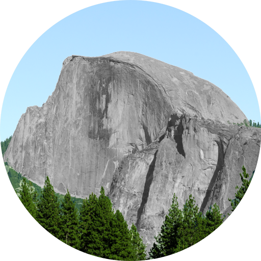
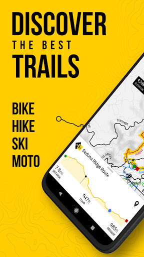
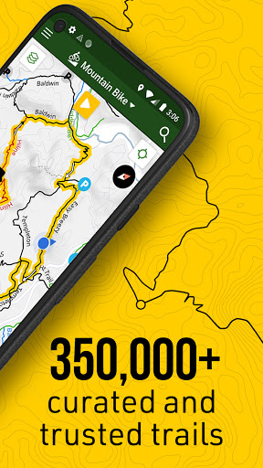
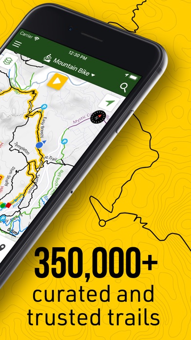
Trailforks is a trail database with over 350,000 trails for Mountain Biking, Hiking, Trail Running, Dirtbiking, Observed Trials, Horse Riding, Snowmobiling and Skiing. Users can contribute data and then local trail associations have the control to approve & curate the data.
The Trailforks app is your mobile companion to the https://www.trailforks.com website. It allows you to download offline trail maps for use on your rides!
You can freely use all features of the app anywhere in the world for 7 days of use. After that a subscription to Trailforks Pro is required to view full map detail outside a city-sized free area of your choosing.
App Features:
- The largest database of mountain bike trails in the world, growing in other sports fast!
- Thousands of related activity POI's
- Offline trail maps and info. Region updates are incremental and fast
- Trail name labels pained alongside trail
- See your GPS location on the map, for trail navigation
- Switch context of map based on your selected sporting activity
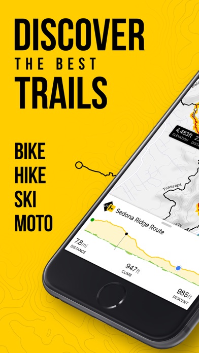
- Display trail & route elevation profiles and 'scrub' along them to see the location on the map
- View grade of climbs and descents on a trails elevation profile
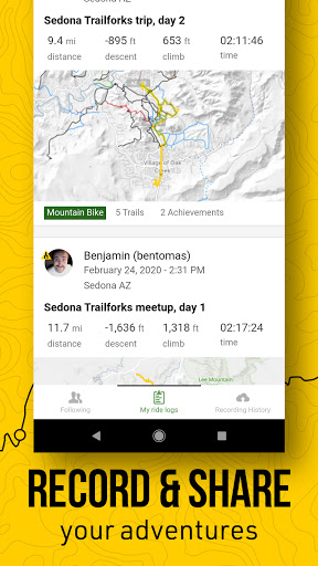
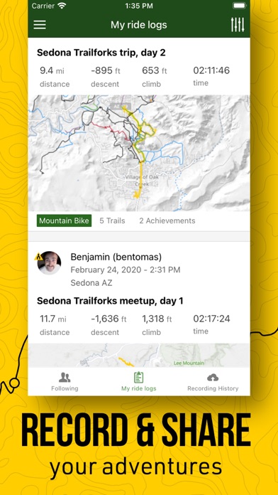
- Record your activity and save to Trailforks or sync to Strava.
- View your friends Ridelogs
- Use your phone’s compass to orientate the map in the direction you’re facing
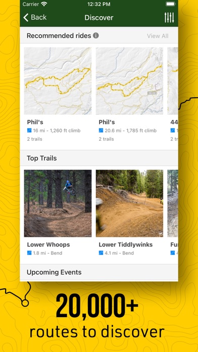
- Discover local routes that riders & hikers have created
- View trail Ridelogs from users and discover how to ride a new trail
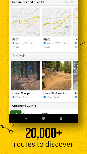
- Discover top trails nearby, and get personalized recommended routes
- Toggle Pro layers on map such as slope angle, light pollution, USFS, land ownership, avalanche data and more!
- Switch between an ever growing list of basemaps
- Automatic trail routing from your location (or nearest parking lot), to the trailhead of your choosing
- Sync and view your saved 'Route Plans' from https://www.trailforks.com/ridelog/planner/
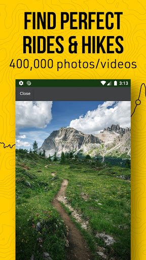
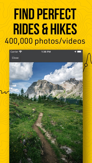
- Lookup region & trail info including 650,000+ photos & videos
- Follow race course routes including colored stages and checkpoints
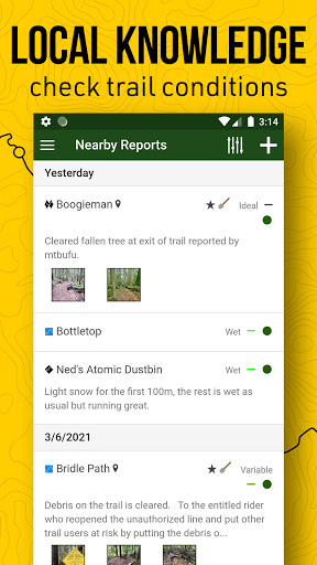
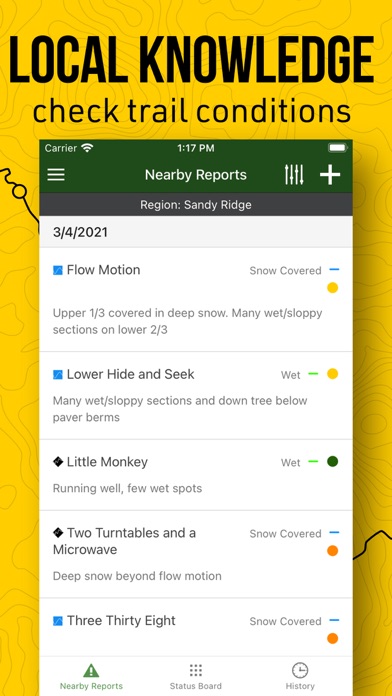
- View trail status & reports! Always be informed of up-to-date trail conditions & closures
- Submit trail reports & conditions from the app, including taking photos of trail issues
- Support the areas you ride, by donating 'Trail Karma'
- View nearby bike shops on the map, quick links for directions or phoning the shop
- View trails on map color coded by popularity or view a heatmap
- View custom worldwide topo contour maps designed for outdoor sports
- View popular Strava segments on the map to up your game
- Overlay of US land owners like the BLM
- View polygons on map, such as private property areas or closed areas
- View upcoming events nearby or by specific region
- View local trail badges you can earn by recording your rides
- Save trails to your wishlist
- Share routes, rides & trails with friends, share via QRCode
- Download GPX of trails & routes. Sync with your Garmin device
- Winter trail map for fatbike trails
- View average time it takes to ride a trail
- Location based global search
- Read and comment on trails, rate trails
- Filter trails on map by bike, great for adaptive bikers or ebikes
- Share your map location with a friend or emergency services
Detailed trail maps of popular mountain biking destinations such as, Whistler, Squamish, North Shore, Kamloops, Nelson, Moab, Sedona, Park City, Hurricane, Downieville, Colorado Springs, Bellingham, Bentonville, Finale Ligure, Pisgah, Marin, Bend Oregon, Wellington & Rotorua New Zealand.
The Trailforks app is your mobile companion to the https://www.trailforks.com website. It allows you to download offline trail maps for use on your rides!
You can freely use all features of the app anywhere in the world for 7 days of use. After that a subscription to Trailforks Pro is required to view full map detail outside a city-sized free area of your choosing.
App Features:
- The largest database of mountain bike trails in the world, growing in other sports fast!
- Thousands of related activity POI's
- Offline trail maps and info. Region updates are incremental and fast
- Trail name labels pained alongside trail
- See your GPS location on the map, for trail navigation
- Switch context of map based on your selected sporting activity
- Display trail & route elevation profiles and 'scrub' along them to see the location on the map
- View grade of climbs and descents on a trails elevation profile
- Record your activity and save to Trailforks or sync to Strava.
- View your friends Ridelogs
- Use your phone’s compass to orientate the map in the direction you’re facing
- Discover local routes that riders & hikers have created
- View trail Ridelogs from users and discover how to ride a new trail
- Discover top trails nearby, and get personalized recommended routes
- Toggle Pro layers on map such as slope angle, light pollution, USFS, land ownership, avalanche data and more!
- Switch between an ever growing list of basemaps
- Automatic trail routing from your location (or nearest parking lot), to the trailhead of your choosing
- Sync and view your saved 'Route Plans' from https://www.trailforks.com/ridelog/planner/
- Lookup region & trail info including 650,000+ photos & videos
- Follow race course routes including colored stages and checkpoints
- View trail status & reports! Always be informed of up-to-date trail conditions & closures
- Submit trail reports & conditions from the app, including taking photos of trail issues
- Support the areas you ride, by donating 'Trail Karma'
- View nearby bike shops on the map, quick links for directions or phoning the shop
- View trails on map color coded by popularity or view a heatmap
- View custom worldwide topo contour maps designed for outdoor sports
- View popular Strava segments on the map to up your game
- Overlay of US land owners like the BLM
- View polygons on map, such as private property areas or closed areas
- View upcoming events nearby or by specific region
- View local trail badges you can earn by recording your rides
- Save trails to your wishlist
- Share routes, rides & trails with friends, share via QRCode
- Download GPX of trails & routes. Sync with your Garmin device
- Winter trail map for fatbike trails
- View average time it takes to ride a trail
- Location based global search
- Read and comment on trails, rate trails
- Filter trails on map by bike, great for adaptive bikers or ebikes
- Share your map location with a friend or emergency services
Detailed trail maps of popular mountain biking destinations such as, Whistler, Squamish, North Shore, Kamloops, Nelson, Moab, Sedona, Park City, Hurricane, Downieville, Colorado Springs, Bellingham, Bentonville, Finale Ligure, Pisgah, Marin, Bend Oregon, Wellington & Rotorua New Zealand.
{{descriptionMoreText}}
Comments (0)
{{commentText.length}}/{{maxCommentText}}
{{commentError}}{{commentUserError}}
-
{{comment.commentUser.substring(0, 1)}}By {{comment.commentUser}}{{comment.commentDateString}}
Category Top
apps
- Google Play
- App Store


More Apps


