


 Art & Design
 Auto & Vehicles
 Beauty
 Business
 Education
 Entertainment
 Finance
 Food & Drink
 Health & Fitness
 House & Home
 Libraries & Demo
 Lifestyle
 Maps & Navigation
 Medical
 Music & Audio
 Parenting
 Personalization
 Photography
 Productivity
 Shopping
 Social
 Sports
 Tools
Tools Travel & Local
 Video Players
 Weather
 Family


 Kananaskis Trail Map
OS :
Version :4.0
Size :83.82Mb
Updated :Jun 2,2015
Developer :David Crawshay
 Ask AI
 Ask AI
Pros and Cons from users' feedback
Based on the users' reviews of the Kananaskis Trail Map app, here are three pros and cons in English, with 15 words limited for each item:
**Pros:**
1. Accurate trail maps and GPS navigation help users explore Kananaskis Country efficiently.
2. User-friendly interface and clear directions make it easy to plan and navigate trails.
3. Offline access to maps and GPS allows users to enjoy the wilderness without data worries.
**Cons:**
1. Some users find the app's search function slow and difficult to use for finding specific trails.
2. Limited information on trail conditions, including weather and maintenance updates, is a drawback.
3. A few users experienced issues with the app's accuracy, particularly with respect to trail distances and elevation gain.
App
Downloads
<
>

App
Survey
-
Does the update frequency of the application affect the experience?
-
What is the number of APPs on your phone?
-
How much traffic the app consumes Does it affect the experience?
-
Where do you get the new APP
Description
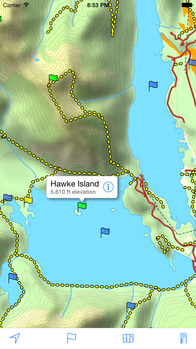
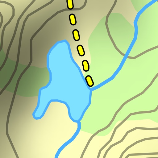
A topographical map of Kananaskis Country, Alberta, Canada.
The trails on the map include Burstall Pass, Chester Lake, Rawson Lake, Elbow Lake, Ptarmigan Cirque, Nihahi, Moose Mountain, and Ribbon Falls.
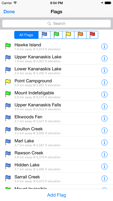
- Search or browse the names of trails, mountains, lakes, rivers, creeks, and backcountry campgrounds.
- Track your current location and elevation with GPS (on devices with a GPS receiver).
- Add flags (waypoints) to mark locations, including your current location and elevation.
- Share flags with others using email or message.
- Measure distance by sliding finger across the map.
- Use the map with no Internet connection. The entire map is stored on your device.
Note: This is an unofficial map and is not endorsed by the Government of Alberta.
{{descriptionMoreText}}
Comments (0)
{{commentText.length}}/{{maxCommentText}}
{{commentError}}{{commentUserError}}
-
{{comment.commentUser.substring(0, 1)}}By {{comment.commentUser}}{{comment.commentDateString}}
Developer apps
Category Top
apps
- Google Play
- App Store


More Apps


