


 Art & Design
 Auto & Vehicles
 Beauty
 Business
 Education
 Entertainment
 Finance
 Food & Drink
 Health & Fitness
 House & Home
 Libraries & Demo
 Maps & Navigation
 Medical
 Music & Audio
 Parenting
 Personalization
 Photography
 Productivity
 Shopping
 Social
 Sports
 Tools
Tools Travel & Local
 Video Players
 Weather
 Family


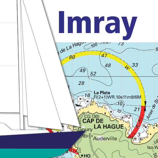 Imray Navigator
OS :
Version :1.4.7
Size :
Updated :May 21,2021
Developer :Imray, Laurie, Norie and Wilson Ltd
 Ask AI
You can ask
the AI some questions about the app
Here are three topics that users may discuss about the app, turned into questions:
1. How does the app's navigation system compare to Google Maps?
2. Are the offline maps and GPS features reliable for outdoor use?
3. Can you personalize the app's settings and customize the navigation experience?
 Ask AI
Pros and Cons from users' feedback
Based on the user reviews, here are three pros and cons for the app:
**Pros:**
1. Easy to use: Intuitive navigation and simple interface make it easy for new users to get started.
2. Accurate tracking: The app accurately tracks the user's location and provides real-time updates.
3. Useful features: Additional features like traffic updates and route optimization make the app a valuable tool.
**Cons:**
1. Limited countries: The app only supports a limited number of countries, which can be frustrating for international users.
2. Occasional bugs: Some users have reported occasional bugs and glitches that can cause frustration.
3. Limited customization: The app lacks customization options, which can lead to a less personalized experience.
App
Downloads
<
>


App
Survey
-
Do you think the aesthetics of the interface UI affects the experience?
-
Application technology innovation Does it affect the experience?
-
Ease of use of the application Does it affect the experience?
-
How much time do you spend on app applications every day?
Description
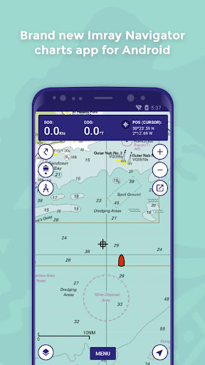
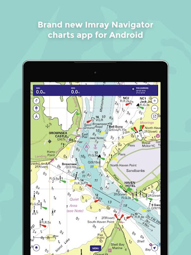
Welcome to Imray Navigator for Android
This is a basic chart plotter app.
Features:
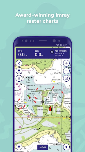
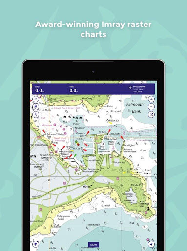
- Award-winning nautical raster charts from Imray and other Hydrographic Offices.
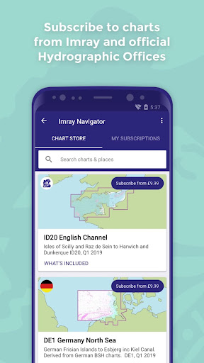
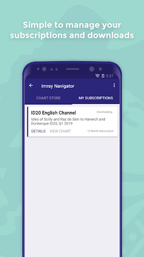
- Chart subscriptions with quarterly updates
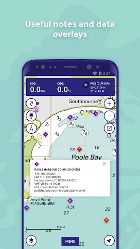
- Data overlays including marina contact details and navigation notes
- Imray login system for sharing subscriptions across Android and Apple devices
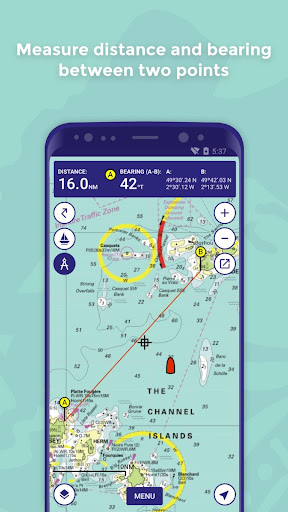
- Routes - plot, edit, share with the crew
- GPS boat position, speed over ground, course over ground
- Tracks - plot and edit
- Waypoints - plot, edit, share with crew
- Distance measure
Please let us know what you think by emailing [email protected].
This is a basic chart plotter app.
Features:
- Award-winning nautical raster charts from Imray and other Hydrographic Offices.
- Chart subscriptions with quarterly updates
- Data overlays including marina contact details and navigation notes
- Imray login system for sharing subscriptions across Android and Apple devices
- Routes - plot, edit, share with the crew
- GPS boat position, speed over ground, course over ground
- Tracks - plot and edit
- Waypoints - plot, edit, share with crew
- Distance measure
Please let us know what you think by emailing [email protected].
{{descriptionMoreText}}
Comments (5)
{{commentText.length}}/{{maxCommentText}}
{{commentError}}{{commentUserError}}
-
{{comment.commentUser.substring(0, 1)}}By {{comment.commentUser}}{{comment.commentDateString}}
-
jBy jean pierre lapreJul 31,2022
-
ABy Alexandre RenardJun 20,2022
-
LBy Lulu CasaMay 27,2022
-
JBy Jf DachetMar 1,2022
-
NBy Nicolas BeaulatonJun 20,2021
Developer apps

Category Top
apps
- Google Play
- App Store
4
5
Lifestyle
 Daily Diary:Journal with Lock
 Life360: Find Family & Friends
 Pinterest
 T-Mobile Tuesdays
 Frecuencia
Photography
 Picsart AI Photo Editor, Video
 Amazon Photos
 Time Warp Scan - Face Scanner
 ToonApp: Cartoon Photo Editor
 Pixelup - AI Photo Enhancer


More Apps


