


 Art & Design
 Auto & Vehicles
 Beauty
 Business
 Education
 Entertainment
 Finance
 Food & Drink
 Health & Fitness
 House & Home
 Libraries & Demo
 Maps & Navigation
 Medical
 Music & Audio
 Parenting
 Personalization
 Photography
 Productivity
 Shopping
 Social
 Sports
 Tools
Tools Travel & Local
 Video Players
 Weather
 Family


 Compass (Altimeter, Sunrise, S
OS :
Version :3.3.4
Size :
Updated :Jul 3,2022
Developer :PixelProse SARL
 Ask AI
You can ask
the AI some questions about the app
Here are three topics that users may discuss when it comes to the Compass app:
1. How accurate is the Compass app in tracking directions?
2. Can the app help me navigate during emergencies or off-grid?
3. Are there any additional features or settings that enhance the app's performance?
(Remember to respond within 20 words for each topic!)
 Ask AI
Pros and Cons from users' feedback
Based on the user reviews, here are the conclusions:
**Pros:**
1. Accurate readings and reliable compass functionality.
2. Simple and easy-to-use interface, perfect for navigation.
3. Effective low-power mode for extended battery life.
**Cons:**
1. Limited features and basic functionality compared to others.
2. Ads can be distracting and interruptive, ads can be removed by upgrading to pro version.
3. occasional freezing or lagging issues reported by some users.
App
Downloads
<
>


App
Survey
-
Do you think the phone comes with a full-featured tool app?
-
Why do you uninstall an app?
-
Do you download your favorite tool app separately?
-
What is your Mobile System?
Description
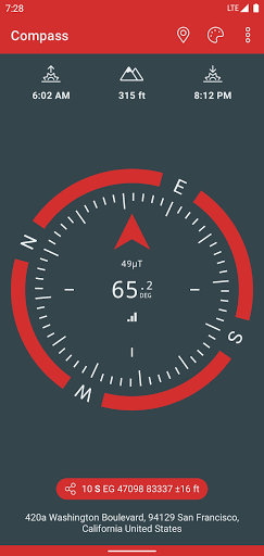
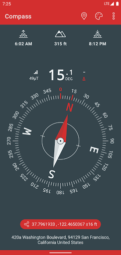
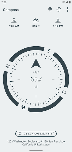
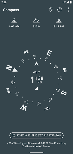
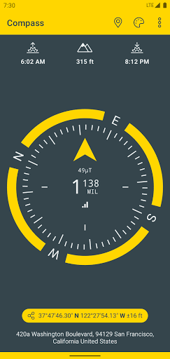
A simple and easy to use Compass to retrieve useful information about your current position.
• Free and without Ads
• Magnetic & geographic north using magnetic declination
• Sunrise & Sunset time
• Various skins and color themes (including high contrast)
• True altitude above sea level at your current position
• Use EGM96 as the geoid reference for computing altitude
• Latitude & Longitude in MGRS format
• Latitude & Longitude in UTM format
• Latitude & Longitude in DD, DMM or DMS format
• Magnetic field strength
• Sensor accuracy
• Address of your current location
Compass better works outside where magnetic perturbations are low. Magnetic closure cell phone cases may also disrupt the accuracy of the compass.
EGM96 (Earth Gravitational Model) is used as the geoid reference to compute true altitude above sea level from data collected by the GPS sensor. UTM (Universal Transverse Mercator) is a system for assigning coordinates to locations on the surface of the Earth.
Have fun !
{{descriptionMoreText}}
Comments (5)
{{commentText.length}}/{{maxCommentText}}
{{commentError}}{{commentUserError}}
-
{{comment.commentUser.substring(0, 1)}}By {{comment.commentUser}}{{comment.commentDateString}}
-
TBy The BambiAug 21,2022
-
DBy Dan McCulloughAug 21,2022
-
GBy Graham KerridgeAug 21,2022
-
PBy PRATIK MOHAPATRAAug 21,2022
-
RBy Roman MarchenkoAug 21,2022


Category Top
apps
- Google Play
- App Store
4
5
Lifestyle
 Daily Diary:Journal with Lock
 Life360: Find Family & Friends
 Pinterest
 T-Mobile Tuesdays
 Frecuencia
Photography
 Picsart AI Photo Editor, Video
 Amazon Photos
 Time Warp Scan - Face Scanner
 ToonApp: Cartoon Photo Editor
 Pixelup - AI Photo Enhancer


More Apps


