


 Art & Design
 Auto & Vehicles
 Beauty
 Business
 Education
 Entertainment
 Finance
 Food & Drink
 Health & Fitness
 House & Home
 Libraries & Demo
 Lifestyle
 Maps & Navigation
 Medical
 Music & Audio
 Parenting
 Personalization
 Photography
 Productivity
 Shopping
 Social
 Sports
 Tools
Tools Travel & Local
 Video Players
 Weather
 Family


 Map Points - GPS Location Storage for Hunting, Fishing and Camping with Map Area Measurement
OS :
Version :3.0.5
Size :4.76Mb
Updated :Oct 30,2015
Developer :David Morneault
 Ask AI
You can ask
the AI some questions about the app
Here are three potential topics with questions:
1. Is the app's GPS tracking accurate and reliable, especially in areas with limited cell signal?
2. How does the app's storage system work, and are the data and coordinates secure and backed up?
3. Have you used the app for hunting or fishing, and what are the most valuable features you've found for your outdoor activities?
 Ask AI
Pros and Cons from users' feedback
Based on the user reviews, here are three cons and three pros, 15 words limited for each item:
**Cons:**
1. Unreliable GPS signal led to lost trails and frustration while hunting or fishing.
2. Some users experienced frequent crashes and freezes, disrupting their outdoor activities.
3. Limited offline maps and lack of clear instructions caused frustration for users.
**Pros:**
1. Accurate and detailed maps helped users navigate through unfamiliar territories.
2. Ability to mark and save custom points and routes made planning and tracking easy.
3. User-friendly interface and clean design made it simple to access and use features.
App
Downloads
<
>
App
Survey
-
Does the update frequency of the application affect the experience?
-
How much traffic the app consumes Does it affect the experience?
-
Whether the app response speed affects the experience?
-
Where do you get the new APP
Description
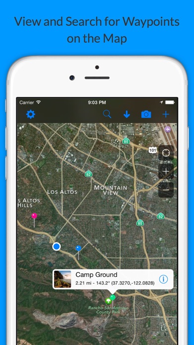
Want to store custom locations? mapPoints will store all of your favorite locations in one spot. This app is great for traveling, if you would like to store your locations and take a snapshot of where you were. It is also great for hunting or fishing or any activity that a specific coordinate is needed. There are four ways you can store your location -
1. Your current location.
2. You can enter an address.
3. You can store a custom latitude and longitude coordinate.
4. You can drop a pin on the map where ever you would like.
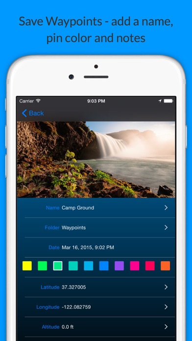
The location information is all editable after you store it.
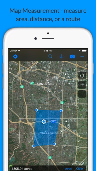
There is an option to draw lines between the map location displayed on the map. You can draw a line between all of the locations in the order selected including the user location. You can draw a line from the user location to the last location selected. You can draw a line form the user location to the first location selected. And you can draw a line between all of the points excluding the user location. This last option is handy when trying to compute distance on a map. When drawing any lines on the map, the distance is displayed in the lower right corner of the screen.
There is a meter on the main page that measures the accuracy of the GPS signal.
You can display your heading and altitude on the main page as an option.
{{descriptionMoreText}}
Comments (0)
{{commentText.length}}/{{maxCommentText}}
{{commentError}}{{commentUserError}}
-
{{comment.commentUser.substring(0, 1)}}By {{comment.commentUser}}{{comment.commentDateString}}
Developer apps


Category Top
apps
- Google Play
- App Store


More Apps


