


 Art & Design
 Auto & Vehicles
 Beauty
 Business
 Education
 Entertainment
 Finance
 Food & Drink
 Health & Fitness
 House & Home
 Libraries & Demo
 Lifestyle
 Maps & Navigation
 Medical
 Music & Audio
 Parenting
 Personalization
 Photography
 Productivity
 Shopping
 Social
 Sports
 Tools
Tools Travel & Local
 Video Players
 Weather
 Family


 FishTrack - Charts & Forecasts
OS :
Version :2.1.1
Size :49.71Mb
Updated :Sep 20,2022
Developer :Surfline/Wavetrak
 Ask AI
You can ask
the AI some questions about the app
Here are three topics that users might discuss about the FishTrack app, turned into questions:
1. What do you think about the accuracy of FishTrack's nearshore forecast in your local area?
2. How easy or difficult did you find it to navigate the app's features and settings on your first try?
3. Have you noticed any improvements or changes in the app's performance since you started using it regularly?
 Ask AI
Pros and Cons from users' feedback
Based on the user reviews of FishTrack: Charts & Forecasts app, here are three pros and three cons:
Pros:
1. "Very detailed and accurate fishing forecasts, helps me plan my trips perfectly."
2. "Love the user-friendly interface, easy to navigate and understand the data."
3. "The app is incredibly useful for surf fishing, helps me anticipate tides and conditions."
Cons:
1. "Sometimes the app takes a while to load, which can be frustrating when planning a trip."
2. "The app requires a subscription fee, which can be a bit expensive for casual users."
3. "Occasionally, the forecasts don't match real-world conditions, which can be disappointing."
App
Downloads
<
>
App
Survey
-
Does the feedback of the application affect the experience?
-
Does the update frequency of the application affect the experience?
-
What is your Mobile System?
-
What is the number of APPs on your phone?
Description
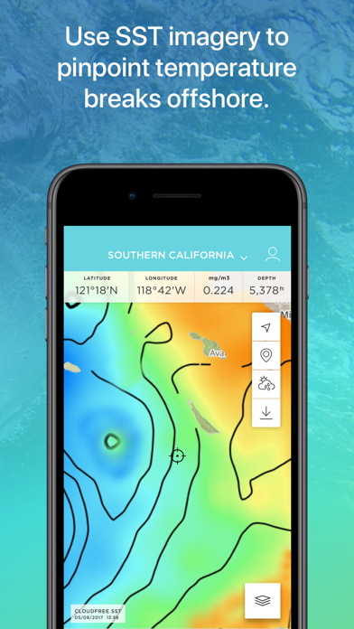
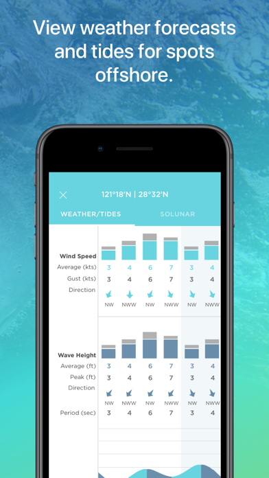
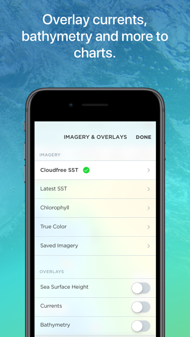
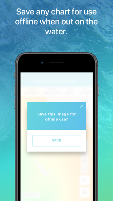
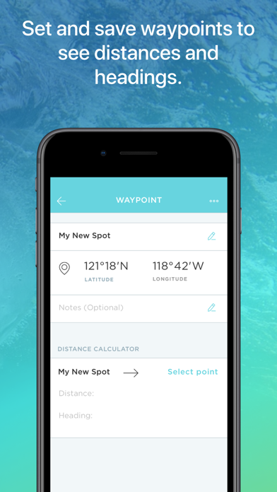
FishTrack provides saltwater anglers with everything they need to find fish. The FishTrack app offers Cloud-free Sea Surface Temperature (SST) charts, high-definition global satellite imagery, including water temperature charts, water color, currents, tides, moon phase and marine weather forecasts – all in one layered tool. Users can mark ‘hot spots’ and record GPS locations of temperature breaks and color barriers. Save imagery and overlay data for offline use to identify bite zones while navigating offshore.
With FishTrack you can:
-View the Latest SST and Chlorophyll imagery
-Mark, name and save data of potential hot spots
-Save fishing chart imagery for offline use
-Plot waypoints and calculate distances
-Overlay bathymetry, ocean currents and sea surface height
-View marine weather forecasts
-View your current location while offline
Don't fish blind. Save time and fuel with the FishTrack app. Download now to get started!
We want to hear from you! Submit your questions or comments through our app to let us know what you think. If you'd like to speak directly with our customer service team, please e-mail us at: [email protected].
— FishTrack Premium purchase small print —
• Subscription services/benefits (described above) are rendered for 1 month or 1 year period depending on product selection
• Payment will be charged to iTunes Account at confirmation of purchase
• Subscription automatically renews unless auto-renew is turned off at least 24-hours before the end of the current period
• Account will be charged for renewal within 24-hours prior to the end of the current period, and identify the cost of the renewal
• Subscriptions may be managed by the user and auto-renewal may be turned off by going to the user's Account Settings after purchase
• Any unused portion of a free trial period, if offered, will be forfeited when the user purchases a subscription to that publication, where applicable
• Full terms and conditions can be found here https://www.fishtrack.com/terms-of-use http://www.fishtrack.com/privacy-policy/
{{descriptionMoreText}}
Comments (0)
{{commentText.length}}/{{maxCommentText}}
{{commentError}}{{commentUserError}}
-
{{comment.commentUser.substring(0, 1)}}By {{comment.commentUser}}{{comment.commentDateString}}


Category Top
apps
- Google Play
- App Store


More Apps


