


 Art & Design
 Auto & Vehicles
 Beauty
 Business
 Education
 Entertainment
 Finance
 Food & Drink
 Health & Fitness
 House & Home
 Libraries & Demo
 Lifestyle
 Maps & Navigation
 Medical
 Music & Audio
 Parenting
 Personalization
 Photography
 Productivity
 Shopping
 Social
 Sports
 Tools
Tools Travel & Local
 Video Players
 Weather
 Family


 Firespot: Wildfire app
OS :
Version :5.1.1
Size :16.66Mb
Updated :Aug 18,2022
Developer :Rayner Software LLC
 Ask AI
You can ask
the AI some questions about the app
Here are three potential topics that users may discuss about the Firespot Wildfire App, turned into questions:
1. What features do you think Firespot offers to help users stay informed about wildfires in their area most effectively?
2. How do you plan to use Firespot's real-time alerts and satellite imaging to prepare for potential wildfires?
3. Will Firespot's incident reporting feature help you become more actively engaged in wildfire response efforts in your community?
 Ask AI
Pros and Cons from users' feedback
Based on the users' reviews, here are three pros and three cons of the Firespot Wildfire App:
**Pros:**
1. Accurate wildfire maps and updates keep users informed and prepared.
2. User-friendly interface makes it easy to track and monitor wildfires.
3. Alerts and notifications help users stay safe and avoid danger zones.
**Cons:**
1. Limited availability of data in some areas, leading to incomplete information.
2. App crashes or freezes occasionally, causing frustration and inconvenience.
3. Lack of customization options for personal preferences and settings.
Note: The pros and cons are based on a general analysis of the user reviews and may not reflect the opinions of every individual user.
App
Downloads
<
>

App
Survey
-
How much traffic the app consumes Does it affect the experience?
-
Do you think the payment of application features affects the experience?
-
Application technology innovation Does it affect the experience?
-
Does the frequency of application notifications affect the experience?
Description
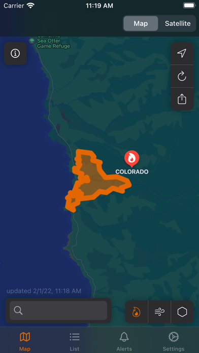
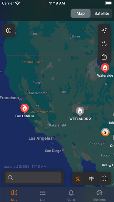
Firespot is the most complete source of wildfire information.
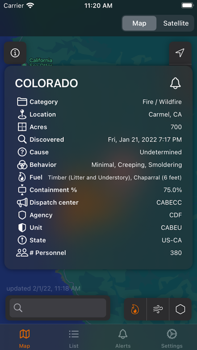
- Perimeters and fire status
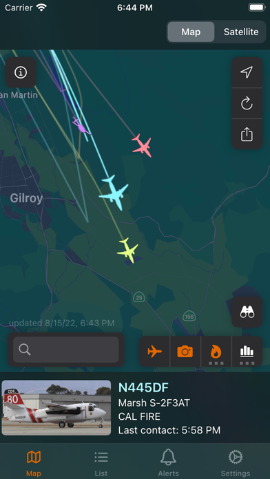
- Aircraft tracking
- Satellite images
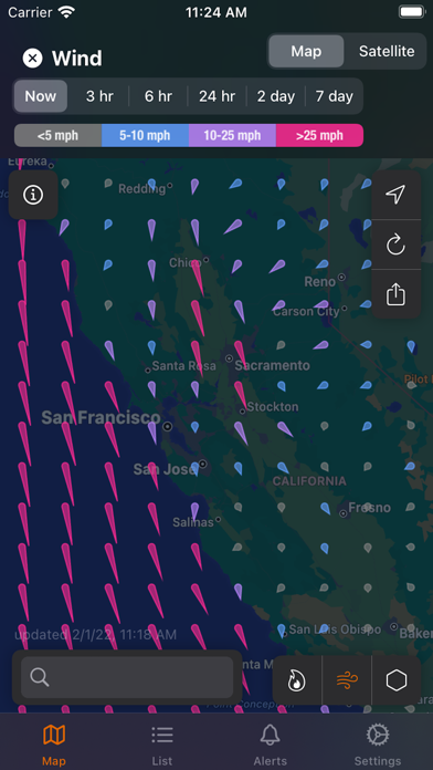
- Wind
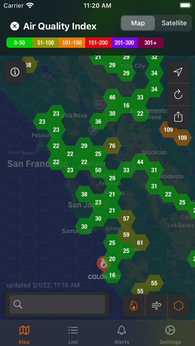
- Air quality
- Red flag warnings
- Satellite-detected fires
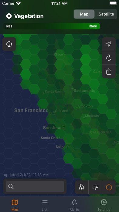
- Satellite climatological data: vegetation, moisture, etc.
Firespot subscribers can activate Alerts to receive notifications on important fire-related events. Set one or multiple areas to monitor, and Firespot will pop an alert on your phone when an important change happens.
FREE TIER:
Use the map, view all fires and red flag warnings.
PAID TIER:
Customized alerts, get notifications on your device, access all satellite images, see real-time firefighting aircraft tracking.
Firespot is not meant as a replacement for local evacuation alerts and information.
Privacy Policy: https://www.firespotapp.com/privacy
Terms of Use: https://www.firespotapp.com/terms
{{descriptionMoreText}}
Comments (0)
{{commentText.length}}/{{maxCommentText}}
{{commentError}}{{commentUserError}}
-
{{comment.commentUser.substring(0, 1)}}By {{comment.commentUser}}{{comment.commentDateString}}


Category Top
apps
- Google Play
- App Store


More Apps


