


 Art & Design
 Auto & Vehicles
 Beauty
 Business
 Education
 Entertainment
 Finance
 Food & Drink
 Health & Fitness
 House & Home
 Libraries & Demo
 Lifestyle
 Maps & Navigation
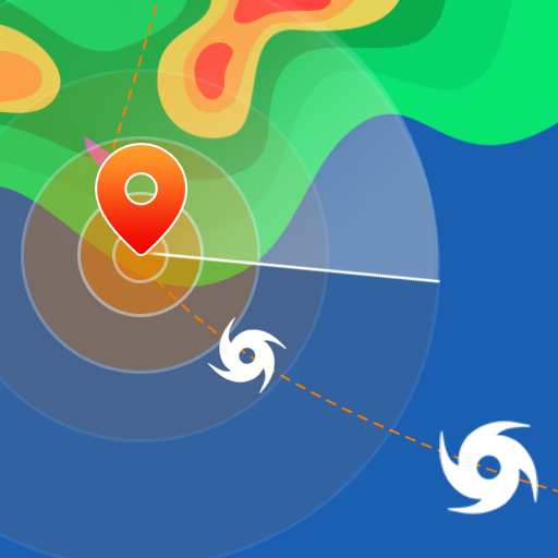
 Medical
 Music & Audio
 Parenting
 Personalization
 Photography
 Productivity
 Shopping
 Social
 Sports
 Tools
Tools Travel & Local
 Video Players
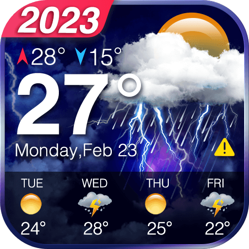
 Weather
 Family


 Avalanche Forecasts
OS :
Version :2.1.0
Size :40.46Mb
Updated :Jun 28,2022
Developer :Sebnarware
 Ask AI
You can ask
the AI some questions about the app
Here are three topics that users most discuss about the Avalanche Forecasts app, turned into questions to ask you:
1. What kind of real-time information do you hope to get from the Avalanche Forecasts app?
2. How do you plan to use the app's weather and snowpack forecasts to stay safe in the backcountry?
3. Are you looking forward to receiving customized avalanche forecasts tailored to your specific activity and location?
 Ask AI
Pros and Cons from users' feedback
Based on the user reviews of the "Avalanche Forecasts" app, here are three pros and cons:
**Pros:**
1. **Accurate forecasts**: Users praise the app's accurate and timely avalanche forecasts, helping them make informed decisions.
2. **Easy to use**: The app is user-friendly, with a simple and intuitive interface, making it easy to navigate and access essential information.
3. **Vital for safety**: Users appreciate the app's critical role in ensuring their safety while skiing, snowboarding, or engaging in other snow-related activities.
**Cons:**
1. ** Limited coverage**: Some users mention that the app's coverage is limited to specific regions or resorts, leaving others without access to vital information.
2. **Bugs and glitches**: A few users report encountering bugs and glitches, which can hinder the app's performance and accuracy.
3. **Outdated data**: Some users express frustration with outdated or delayed data, which can compromise the app's usefulness and effectiveness.
App
Downloads
<
>


App
Survey
-
What is the number of APPs on your phone?
-
The reasons why you choose to exercise are
-
What is the exercise you generally like to do?
-
Do you think the aesthetics of the interface UI affects the experience?
Description
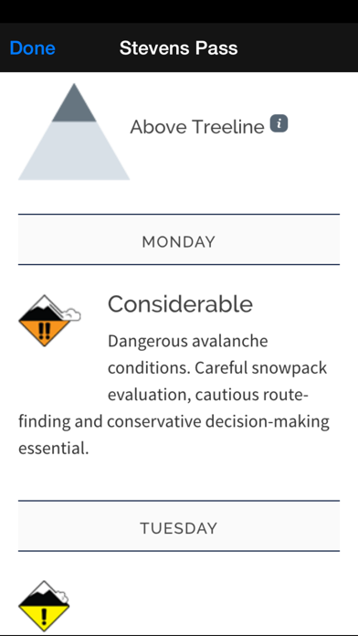
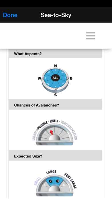
The easiest way to see current avalanche danger levels at-a-glance, for every forecast center in North America!
Bottom-line danger levels are shown color-coded for each forecast region on a map, based on the selected timeframe (Today/Tomorrow/2 Days Out). Click on any region to view the detailed avalanche forecast from the source forecasting center.
All content you've viewed is cached for offline use, so you can refer back to the information you've seen even if you lose coverage in the mountains.
We support 100+ forecast regions, sourced from the NWAC (Northwest US), CAIC (Colorado), UAC (Utah), SAC (Central Sierras), ESAC (Eastern Sierras), MSAC (Mount Shasta), BTAC (Jackson Hole), GNFAC (Bozeman), WCMAC (Missoula), FAC (Kalispell), SNFAC (Sun Valley), IPAC (Idaho Panhandle), PAC (McCall), MWAC (Mount Washington), KPAC (Flagstaff), WAC (NE Oregon), CBAC (Crested Butte), CNFAIC (Chugach), JAC (Juneau), AAC (Anchorage), HAIC (Haines), VAC (Valdez), Cordova, HPAC (Hatcher Pass), Avalanche Canada, Parks Canada, WhistlerBlackcomb, VIAC (Vancouver Island), and Avalanche Quebec (Chic Chocs) forecasting centers. 29 separate integrations to bring you the forecasts you need.
Please contact us at [email protected] with feature suggestions, bug reports, or other feedback.
{{descriptionMoreText}}
Comments (4)
{{commentText.length}}/{{maxCommentText}}
{{commentError}}{{commentUserError}}
-
{{comment.commentUser.substring(0, 1)}}By {{comment.commentUser}}{{comment.commentDateString}}
-
PBy PowdaddyMar 12,2015
-
BBy BearheineFeb 14,2019
-
sBy samuelellerDec 2,2020
-
jBy jimmy mack1Jan 22,2019
Category Top
apps
- Google Play
- App Store


More Apps


